Community
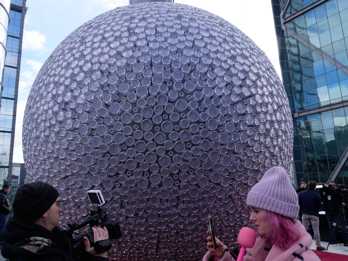
Master carver to engrave crystals from last year's New Year's Eve ball sold as mementos
By Marcus Chen
Advertisement · Why this ad?
Katherine oversees editorial operations across all six brands. Before joining The Meridan Group, she spent 14 years at the Minneapolis Star Tribune, where she led the metro desk through its digital transformation. She holds a Master's in Journalism from Northwestern's Medill School.
More from Katherine →
The sight of iguanas raining from trees might seem like a bizarre anomaly, but it’s a potential consequence of the approaching cold front set to impact South Florida this weekend. While the immediate forecast calls for mostly dry conditions through Thursday, residents should prepare for a significant temperature drop, bringing with it a brief but notable chill that could affect the region’s unique wildlife. According to WPLG Local 10, some clouds will linger across South Florida Thursday night. Temperatures are forecast to drop to near 70°F overnight.
Friday will bring mostly to partly cloudy skies and gentle, northwest winds, with temperatures peaking around 80°F before the cold front arrives in the afternoon. This front will usher in drier, cooler air, a welcome respite from the persistent humidity that often characterizes South Florida. The transition will be swift, with temperatures potentially dropping into the 50s Saturday morning for parts of the region.
The arrival of a cold front in South Florida isn’t just about lower temperatures; it’s a disruption to a carefully balanced ecosystem. The region's subtropical climate is generally mild, which has allowed for the proliferation of non-native species like the green iguana. These iguanas, originally from Central and South America, have thrived in the warm South Florida environment, often causing significant damage to infrastructure and native vegetation. Their presence is a testament to the complex interplay between climate, invasive species, and human activity in the region. Understanding this context is vital when considering the impact of even a relatively short cold snap.
FOX 13 meteorologist Dave Osterberg has been closely monitoring the situation. A blast of cold, dry air is pushing into Florida, delivering the coldest weekend temperatures of the fall season so far across the state. Forecasters expect morning temperatures to dip into the 30s and 40s in northern communities and 50s farther south. Northern Florida will see morning lows fall into the lower 40s, with a few locations plunging into the upper 30s. Central Florida communities can expect readings between the upper 40s and lower 50s. South Florida, however, will see temperatures dip into the 50s Saturday morning, a crucial threshold for the area’s invasive green iguana population. The coldest conditions will settle in during the morning hours on Saturday and Sunday, according to meteorologists.
The Tampa Bay area, while not directly covered in this article’s focus on Coral Gables, experiences similar weather patterns and provides valuable context. Dave Osterberg’s observations from the Tampa region emphasize the statewide nature of this cold front. The fact that temperatures in Tampa are expected to drop into the 40s highlights the intensity of the system and reinforces the potential for significant temperature drops across all of Florida. This broader perspective helps residents understand that this isn’t an isolated event but part of a larger weather trend.
The unusual spectacle of iguanas falling from trees is a direct consequence of these low temperatures. These reptiles, not native to Florida, are ill-equipped to handle prolonged exposure to cold. When temperatures drop below 50°F, they enter a dormancy state, often losing their grip on branches and falling to the ground. While most iguanas cannot tolerate temperatures in the 40s, the majority of the population resides in South Florida, making the potential for this phenomenon a real concern. This is a recurring event, a stark reminder of the ecological impact of invasive species and the challenges of adapting to fluctuating climates. Temperatures in the lower 50s slow the animals down significantly, creating a marginal setup for iguanas to fall out of trees.
The phenomenon of falling iguanas isn’t just a quirky news story; it’s a visible sign of an ecological imbalance. The green iguana population in South Florida has exploded in recent decades, largely due to their ability to thrive in the warm climate and lack of natural predators. Their feeding habits can damage native plants, and their burrowing can destabilize infrastructure. While the cold snap provides a temporary reprieve from the iguana population boom, it doesn't offer a long-term solution. The iguanas are expected to rebound quickly once temperatures rise, highlighting the need for ongoing management strategies.
The current El Niño weather pattern, firmly entrenched for the next several months, is contributing to these unusual temperature swings. El Niño typically brings cooler temperatures and increased rainfall to the region, although this particular cold front represents a welcome break from the persistent cloud cover that has characterized much of the fall. The arrival of dry air behind the front will lead to clearing skies and lower humidity, a welcome change for many residents. By Saturday afternoon, temperatures are forecast to rebound into the mid-70s, with clouds and shower chances returning early next week.
Understanding El Niño's influence is crucial for long-term weather forecasting and planning. El Niño is a climate pattern characterized by warmer-than-average sea surface temperatures in the central and eastern tropical Pacific Ocean. This warming disrupts normal atmospheric circulation patterns, impacting weather conditions around the globe. The current El Niño is expected to persist through the winter months, potentially influencing rainfall patterns, temperatures, and even hurricane activity in South Florida. Local farmers and gardeners are particularly attentive to El Niño forecasts, as they can affect crop yields and planting schedules.
Skies will clear out across the region on Friday as dry air rapidly moves in, bringing afternoon high temperatures into the lower 70s. Residents will need jackets for Friday night and early Saturday morning as overnight lows dip into the 40s for many areas. Sunday morning will start off quite chilly before afternoon temperatures rebound back into the mid-70s, though clouds and rain chances will quickly return afterward. Meteorologists have not yet determined the exact timing and coverage of scattered rain showers expected early next week, nor have they pinpointed just how high afternoon temperatures will climb during the warmup.
Beyond the immediate weather forecast, residents should be aware of potential impacts on infrastructure and daily routines. The sudden temperature drop can stress pipes and irrigation systems, potentially leading to bursts and leaks. Outdoor events may need to be adjusted or postponed. And while the cold snap is expected to be brief, it serves as a reminder that South Florida is not immune to the effects of seasonal weather changes. Preparations for potential cold snaps should become a regular part of household maintenance.
Residents are encouraged to stay informed about weather updates and take necessary precautions to protect themselves and their property. The National Weather Service Miami provides detailed forecasts and warnings. For information on invasive species management and ecological conservation, residents can visit the Florida Fish and Wildlife Conservation Commission website. The Miami-Dade County website offers resources for emergency preparedness and community resilience.
Local community groups and organizations are also playing a vital role in promoting climate resilience and environmental awareness. These groups often offer workshops, educational programs, and volunteer opportunities for residents who want to get involved in protecting the environment. Supporting these local initiatives is a key step in building a more sustainable future for South Florida.
Following the weekend chill, temperatures are expected to rebound, bringing with them a return to more typical South Florida weather. However, the current El Niño pattern suggests that cooler temperatures and occasional cold fronts may continue to impact the region throughout the winter months. It is crucial for residents to remain vigilant and prepared for unpredictable weather events, ensuring the safety and well-being of themselves, their families, and their communities. The cyclical nature of weather patterns underscores the importance of adaptability and resilience in our ever-changing world.
Looking beyond the immediate forecast, scientists are continuing to monitor El Niño’s development and refine long-term weather predictions. Understanding these trends is essential for making informed decisions about everything from agriculture to infrastructure planning. The challenges posed by climate change require a collaborative effort, involving scientists, policymakers, and community members working together to build a more resilient future for South Florida.
The approaching cold front serves as a tangible reminder of the increasing unpredictability of our climate. While the brief respite from humidity and the chance to wear a sweater are welcome, the potential for falling iguanas underscores a larger issue: the ecological disruption caused by invasive species and the challenges of adapting to a changing environment. While the immediate forecast calls for mostly dry conditions through Thursday, residents should prepare for a significant temperature drop, bringing with it a brief but notable chill that could affect the region’s unique wildlife.
The situation also highlights the importance of scientific literacy and critical thinking. While the image of falling iguanas is often met with amusement, it's crucial to understand the underlying science and ecological implications. Promoting science education and encouraging informed discussions about climate change are essential for building a resilient and sustainable community.
By Marcus Chen

By Katherine Langford

By Katherine Langford

By Katherine Langford